The film version of this script is here on Google Drive
Handhelds: Site navigation in box at top of page.
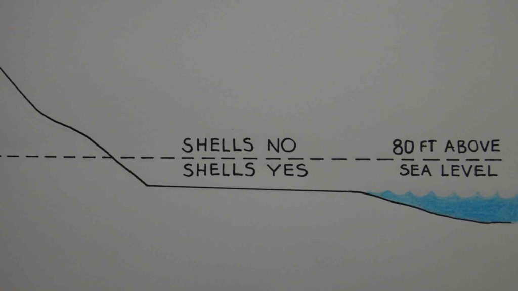
All around the world, we find occasionally find un-fossilized sea-shells that are strangely in places miles inland and up to about 80 feet above sea level. I collected 141 of these shells from places in San Diego & Los Angeles.
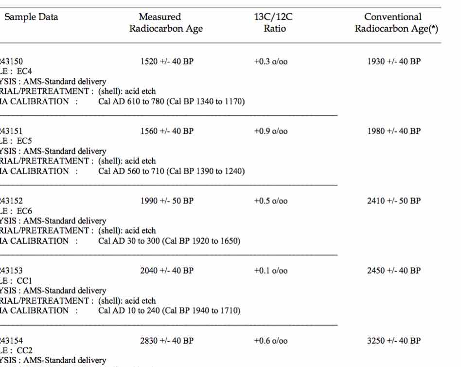
Then I sent the shells for carbon dating at a cost of about $112,000. Here above is one of the test result pages.
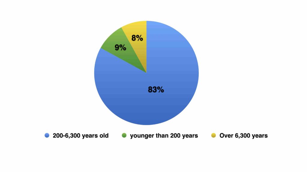
The carbon dating showed that 83% of the shells were between 200 and 6,300 years old.
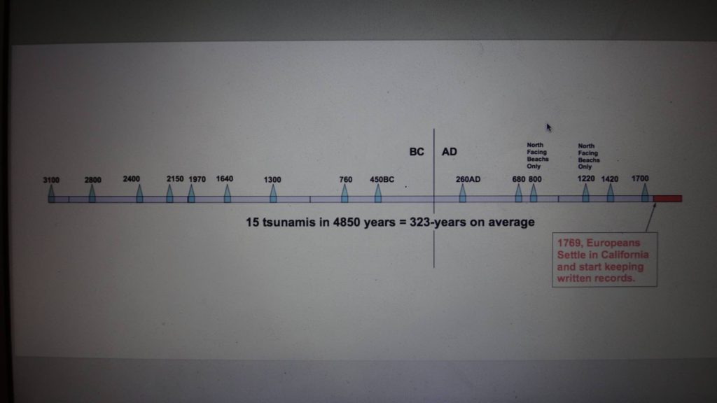
The carbon dating also revealed date clusters which are shown in this timeline. Thus Southern California appears to have suffered 15 large tsunamis in the last 5100 years. The last tsunami being in around 1700AD.
If we divide the 4,800-year period between these tsunamis into 14 parts, we get an average interval of 343-years. This is similar to the tsunami intervals seen in Washington state and the nation of Chile, where scientists used tree rings and sediment layers to date tsunamis.
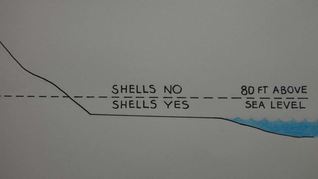
Now I especially looked for shells in high places… and I occasionally found them in places up to about 80 feet above sea level in Southern California. But I couldn’t find any shells above this elevation. So it appears that the shells were not from human activity, but deposited by tsunamis. After all: why would humans only throw away shells always close to sea level, but often many miles inland?
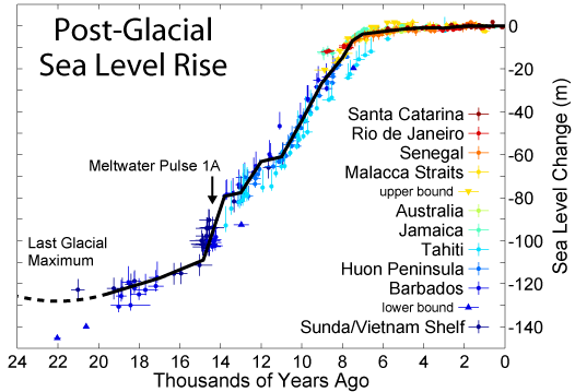
Now if you are thinking that the shells were from a time where sea levels were higher, that can’t be. The age of the shells combined with historical sea level data contradicts this idea. The last time sea levels were higher than today — was about 110,000 years ago, and the shells we find are all mostly from the last 6,300 years.
Also, the age of the shells matches up fairly perfectly with the plateau in sea levels shown on this graph. Before this time, the planet was still in an ice age, and sea levels were lower.
So a few centuries before 6,300 years ago, tsunamis struck places that are today offshore in the ocean. And this is why we don’t find many un- fossilized shells high up on land that are more than 6,300 years old.
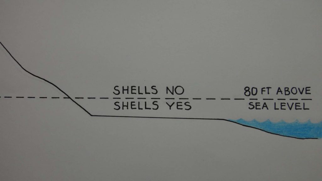
Using seashells to date tsunamis offers a BIG advantage over using sedimentation and tree rings alone. With seashells we see exactly how high the waters got for each tsunami in each location. The tree rings give us precise dates, and the shells tell us how high each tsunami got in each specific location.
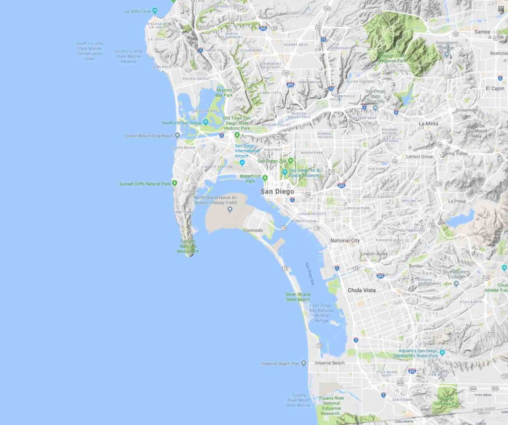
So for example, in Del Mar valley, where the shape of the coastline DOES NOT funnel the tsunami waters, the seashells and tsunami flood waters only seem to get about 30 feet above sea level. But around San Diego harbor, where the coastline DOES funnel the tsunami waters, we find seashells in places up to about 70 feet above sea level.
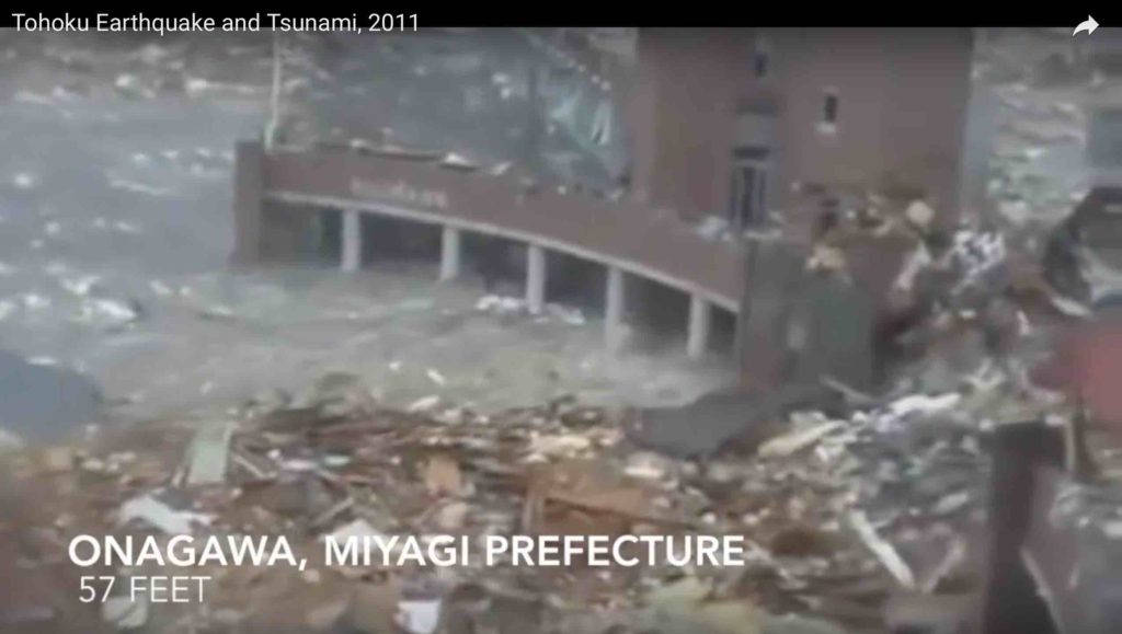
Now it should be noted that a 70-foot inundation of San Diego harbor is no higher than we saw in the recent Japan tsunami of 2011.
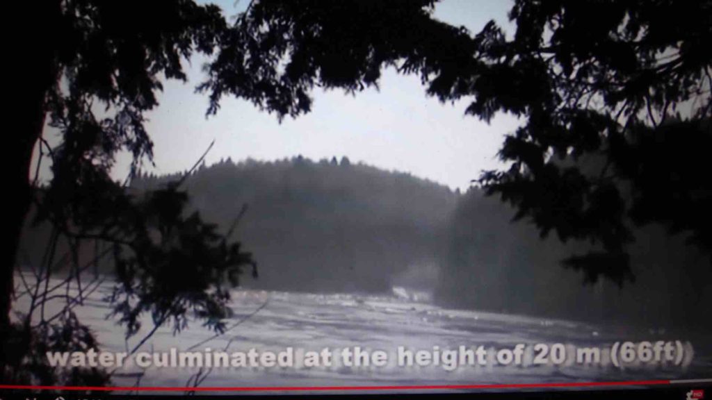
Here’s a town that suffered 66-foot flood waters. a town that was completely washed off the map.
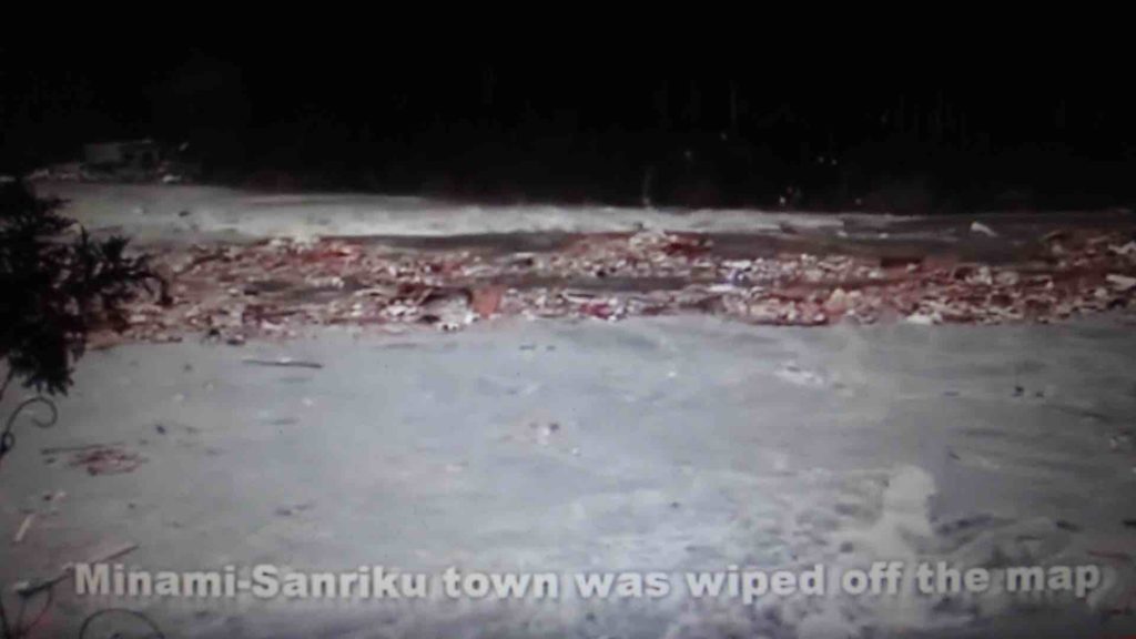
And in the 2011 tsunami, the run-up maximum, the highest level the waters reached was 127-feet above sea level… at a place called Miyako Iwate.
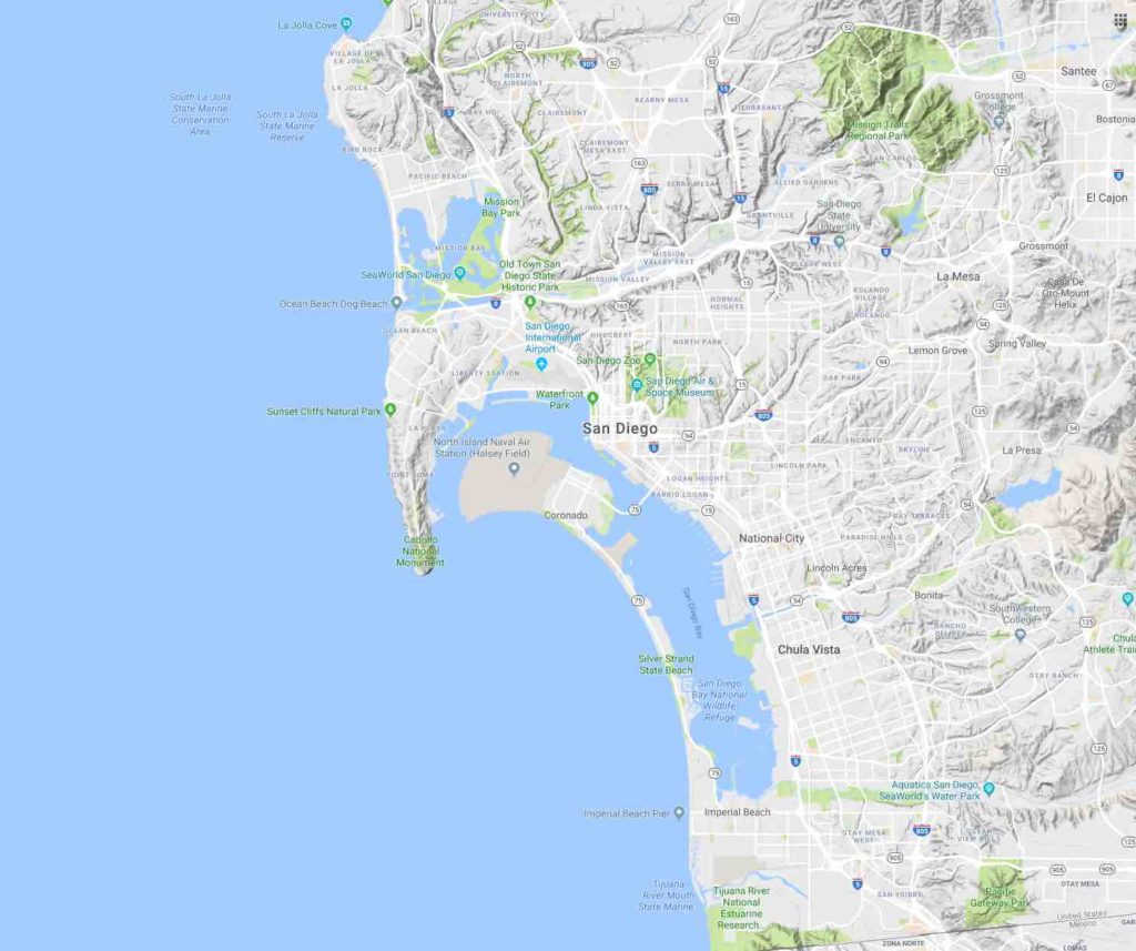
So with San Diego Bay, it seems that the hilly Point Loma peninsula… which points south in this image… acts as a tsunami funnel or scoop for waves arriving from the southwest. And this is why San Diego bay experiences floods as high as 70-feet. The waves get funneled, and this increases their height.
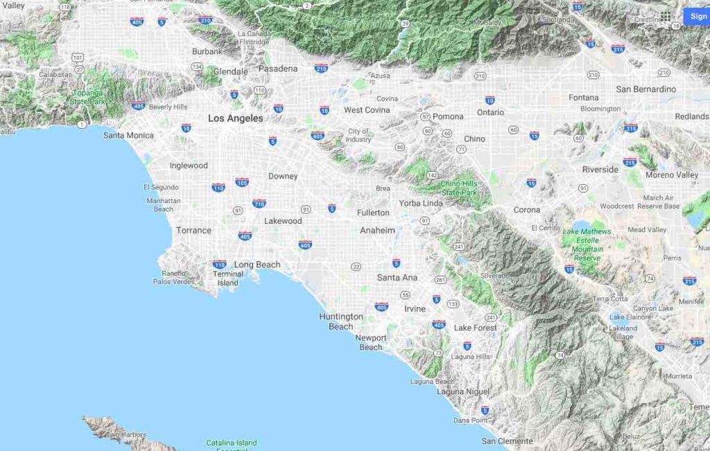
In Los Angeles, the Palos Verdes peninsula forms a tsunami funnel, like the Point Loma peninsula does for San Diego. Although in Los Angeles, the tsunami funnel seems to be bi-directional… So it works for tsunamis arriving from both the west and southwest. This is why we easily find shells miles inland in Los Angeles. For example, some of my carbon-dated shells came from the intersection of Slauson and Sepulveda, just east of the 405 freeway, and about 3 miles inland.
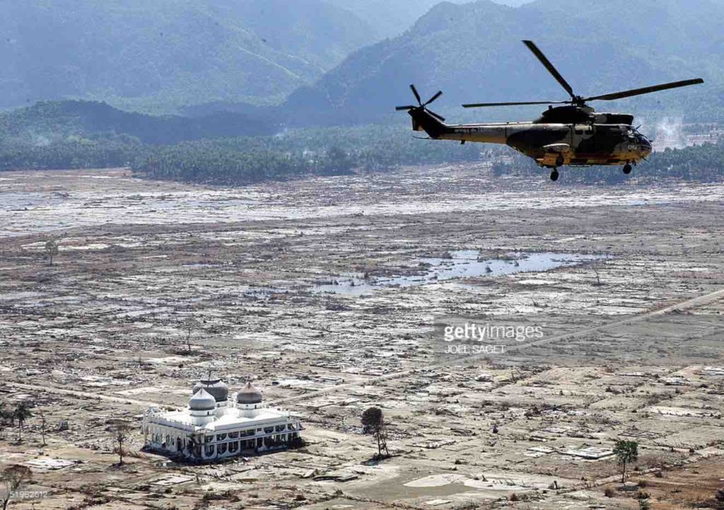
Is it really so hard to believe that much of low-lying coastal California will one day be washed away by a giant tsunami… washed away like in Banda Ache shown here. A quarter million people died in this disaster.
And look at the edge of the tsunami wash area behind the helicopter. Look at how well it matches the topography. So we are probably looking at the cause of this sort of topography… this type of buried-hill coastal-plane that exists in many places around the world, Places like California.
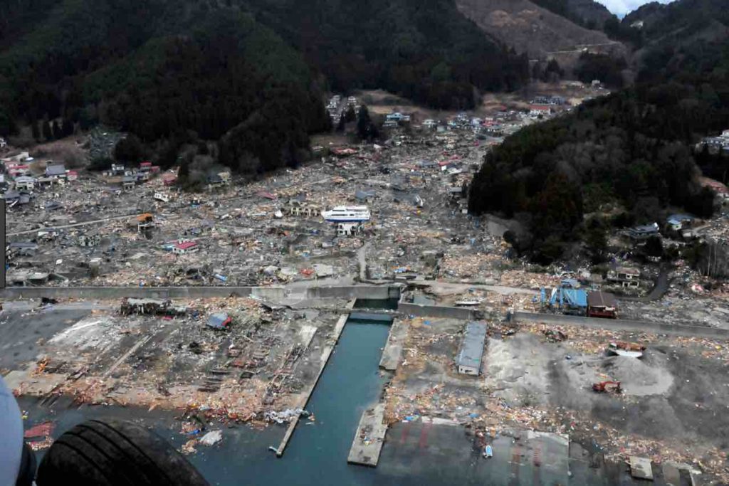
And is it so hard to believe that much of coastal California will one day be washed away… washed away like in Japan shown here. Over 20,000 people died in this tsunami… a tsunami that hit a sparsely populated part of Japan. A place with nearby hills to run to… and a place that holds regular tsunami drills.
Also, look at how the tsunami wash area shown here so perfectly matches the edge of the buried-hill coastal-plane. And there are coastal features like this all up and down the coast of California. And now everyone can read the geology.
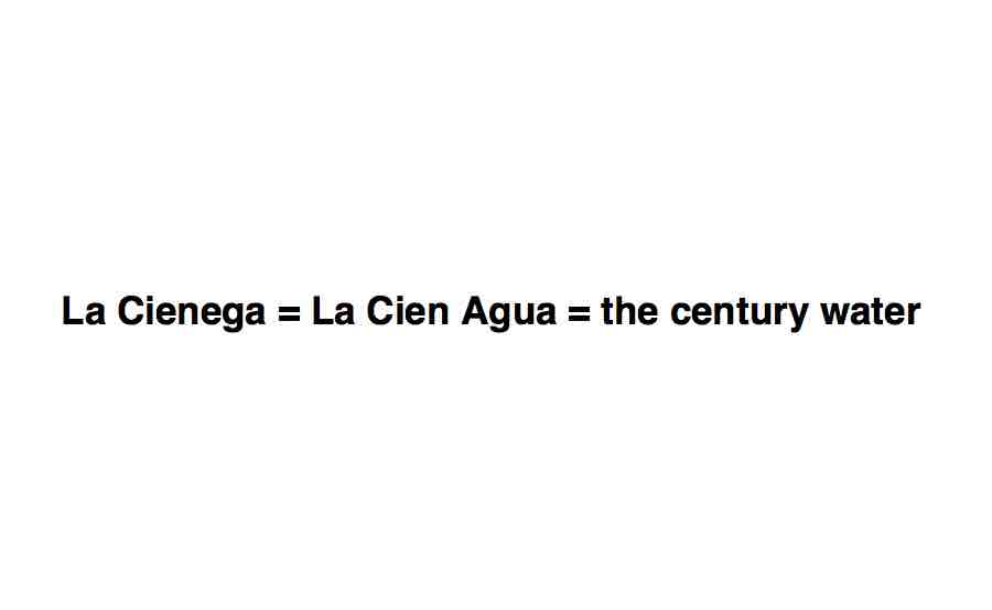
CIEN•AGA is the Spanish word for swamp. So La Cienega Boulevard literally means THE SWAMP ROAD. And CIEN•AGA looks like CIEN•AGUA, which looks like CENTURY•WATER. Thus La Cienega boulevard looks like CENTURY WATER BOULEVARD… or tsunami danger-zone road.
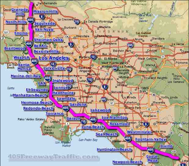
And La Cienega boulevard does run roughly parallel to the coast… about 3 to 6 miles inland. On this map, La Cienaga boulevard is the thin red line running vertically past the A in Los Angeles before it disappears under the 405 freeway, which was built over much of it, at least as far south as Hawthorne. So La Cienega boulevard seems to mark the flood zone from the last century flood, or 350-year tsunami, or whatever we are going to call it.
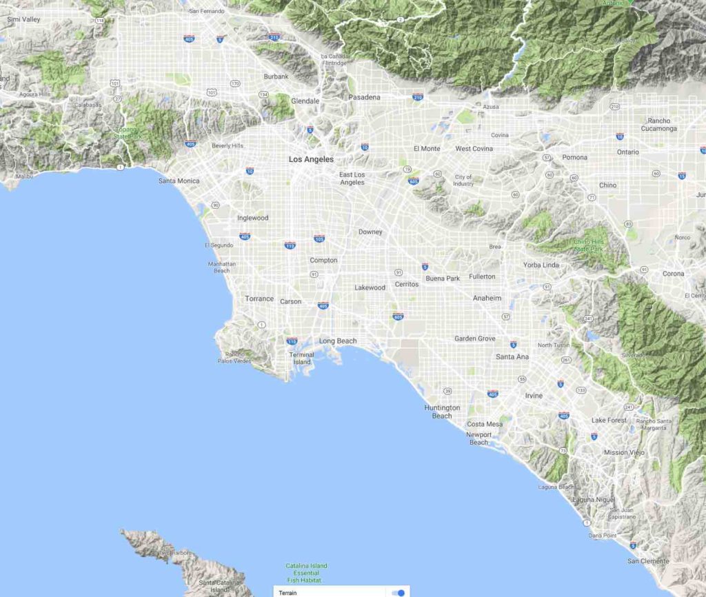
And what of the name Los Angeles, the city of Angels? Perhaps this came from the Native American term for the spirits of the poor people who died in the last tsunami. Perhaps the name Los Angles actually means something like tsunami graveyard, or the place where many people once died in a tsunami. And nearby La Jolla does sounds like Los Hoyos, which also means graveyard in Spanish.
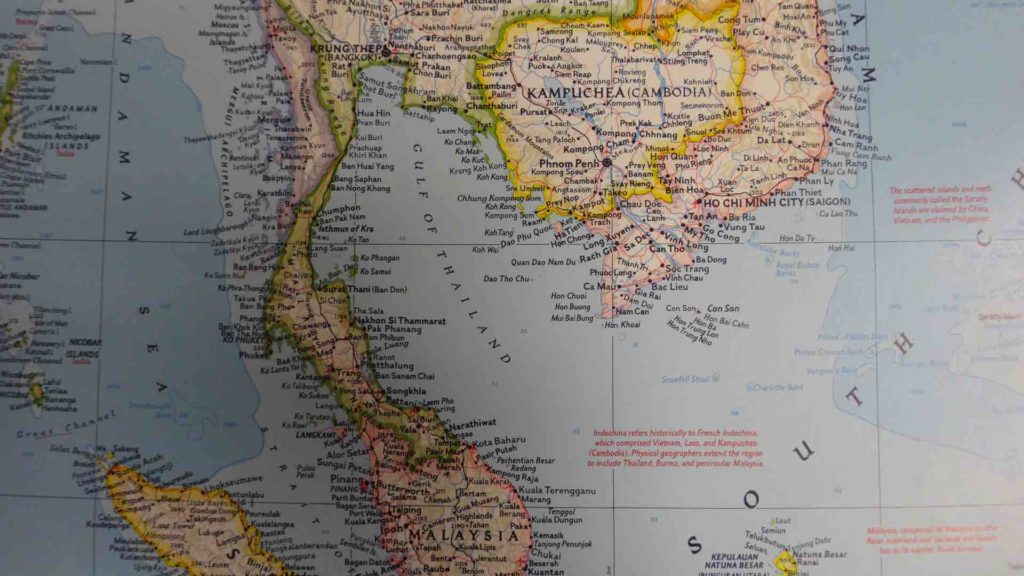
Bangkok Thailand is also in a tsunami funnel… in fact, it is dead center in a giant funnel, a funnel maybe 700 miles across depending on how we measure it. And the Thai name for Bangkok, also means city of angels, just like Los Angeles.
A couple centuries ago, the Thais moved their capital from the safe hills of Chiang Mai into the Jaws of death in Bangkok. Why on earth did the Thai king do this? And how did the Thais forget that this place was once named tsunami graveyard?
Today, Bangkok is ten times the size of the next largest city in Thailand… and it completely dominates Thai culture. So if a tsunami were to strike, only the provincials, the country bumpkins would survive in Thailand. The smartest people of the nation would mostly all be killed off, just like in California, where the richest neighborhoods are all mostly near the beach.
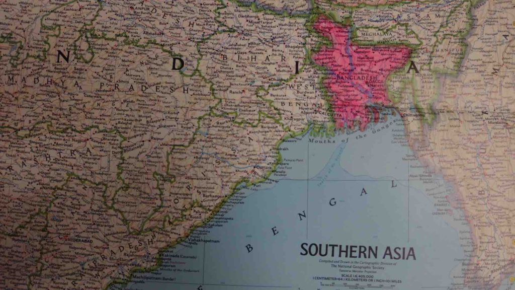
The nation of Bangladesh is also in a giant tsunami funnel… one maybe 900 miles across. And this low-lying nation, barely above sea level, is shaped just like a tsunami wash area (especially if we include the Indian state of West Bengal). So it appears that there was a giant flood, and the Hindu Indians didn’t want to settle in this place afterwards.
So the Muslims from the desert land of no resources moved there and laid claim instead… right in the jaws of death. And this is how a low-lying Islamic enclave came to exist completely surrounded by Hindu India.
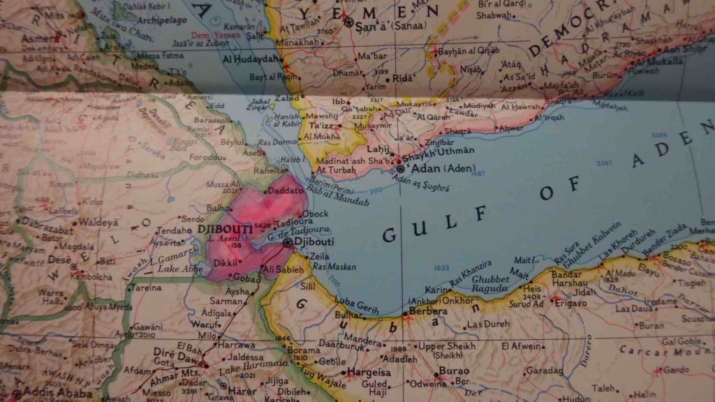
Djibouti is another nation at the end of a tsunami funnel that looks like a tsunami wash area. It also another Muslim enclave surrounded by people of another religion. At least it was initially. Apparently the Christians of Ethiopia didn’t want to settle in this place after the last tsunami, so Muslims settled there instead… right in the jaws of death. Now the people living in Bangladesh and Djibouti, pay Islamic taxes to Arabia, to the desert land of no resources except apparently cleverness, treachery and desperation.
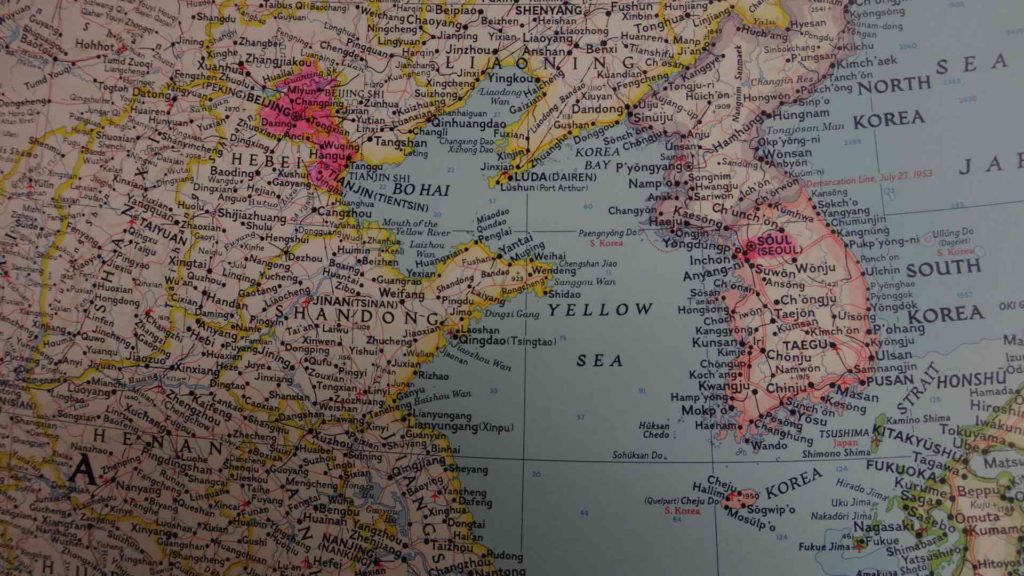
The Chinese provinces of Beijing and Tianjin are also at the end of a giant tsunami funnel one perhaps 500 miles across, depending on the direction of the wave. And the combined shape of these two provinces is quite reminiscent of Bangladesh and Djibouti… so they also look like the area wiped out by a past tsunami.
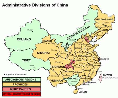
And look at the way Beijing and Tianjin are surrounded by Hebei province. Isn’t it just like how Bangladesh is surrounded by Hindu India? Isn’t it just like how Djibouti is surrounded by Christian lands? And look at how Beijing, Tianjin and Shanghai are strangely much smaller than the other provinces of China.
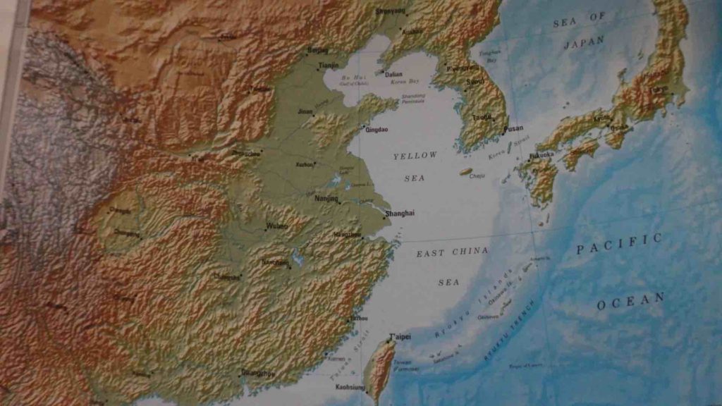
Right after a tsunami, nobody wants the devastated areas. So Arab refugees will frequently move there and simply lay claim. Or maybe they buy the devastated lands for a pittance. Maybe they buy the whole graveyard location for 24 dollars worth of beads or something like that.
Then over many generations they struggle to turn their worthless jaws of death location into valuable urban real estate. For example, in China, they eventually got the government to accept their tsunami lands as the nation’s Beijing, which means “Northern Capital”.
The full 29-minute film version of this script is here on Google Drive.
The full script is here